-16809-p.jpg?v=28077503-4AAE-4829-B734-31C36639CCC9)
-16811-p.jpg?v=D456BAFA-24F7-4D12-BB49-B3450EEF3B4B)
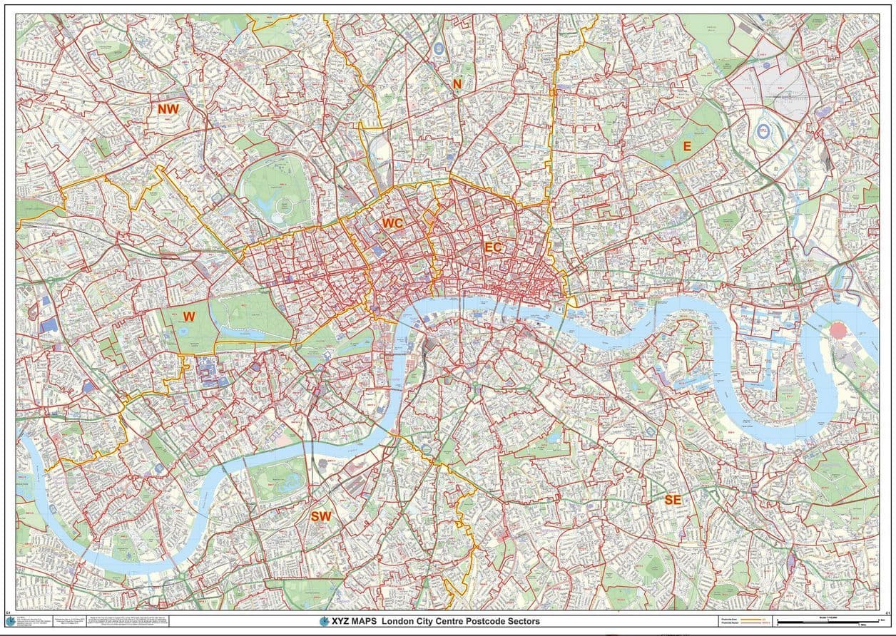


London City Centre - Postcode Sector Wall Map
The London City Centre Postcode Sectors Wall Map shows detailed postcode sector boundaries along with its associated label (EC1 1, EC1 2) on a comprehensive background and is perfect for determining postcode boundaries, for sales, logistics, planning mailshots or as a regional reference guide.
1189 x 841 mm
2018
1:10,000
Choose your map finishPlease select either Paper or Laminated from the drop menu.
Delivery - 3 to 5 days (UK)
Your Map will be sent to you Flat/Rolled in a sturdy Cardboard Tube by Courier.
It will require a signature on delivery or will be left in a safe place.
Customer reviews
| Weight | 2kg |