-22226-p.jpg?v=2969D9FF-276B-46B2-9CF7-86D237458BF8)
-22226-p.jpg?v=B62ACE37-AF52-4162-9F00-6E30D5B8DD69)
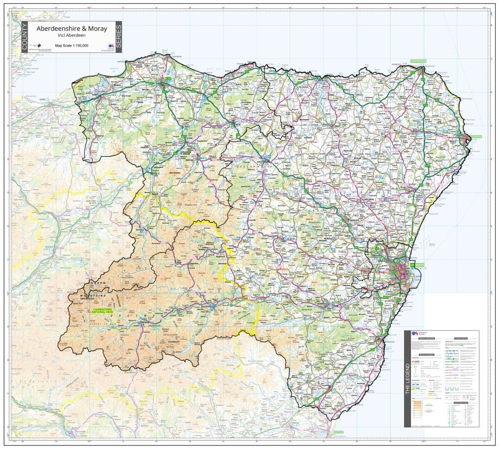


County Map of Aberdeen & Moray
A county wall map of Aberdeen & Moray showing the county boundary and fading out the area beyond.
Map Scale: 1:150,000
Map Size: 100 x 90 cm - approx.
The map uses Ordnance Survey Road Mapping to depict the whole of the county and includes the relevant unitary authority administrative boundaries where appropriate.
Finish Options:
- Printed on 140 gsm* Matt Finish Standard Map Paper
- Printed on 190 gsm* Satin Finish Photographic Paper
- Encapsulated (Laminated) in a tough but crystal clear double sided plastic coating, suitable for use with write-on wipe-off pens. We use 125 micron plastic laminate as this gives the best protection and is sent flat/rolled.
Please use the drop down menu to select your preferred finish option
Delivery (UK) 2 to 5 working days
The map is supplied Flat/Rolled in a sturdy Cardboard Tube.
Publication Date 2021
* gsm = Grams per square metre, of paper. The higher the number the heavier/thicker the paper.
Customer reviews
| Brand | The Map Centre Press |
| Weight | 2kg |
You may also like
-

County Map of Stirling & Falkirk
From: £28.00Stirling & Falkirk - A county wall map showing the county boundary and fading out the area beyond. -

County Map of the Highlands
From: £28.00The Highlands- A county wall map showing the county boundary and fading out the area beyond.